Crews make more progress on Wickiup Fire, now 20% contained, Round Mountain Fire 5% contained
(Update: Saturday update)
La PINE, Ore. (KTVZ) – A pair of 3-day-old wildfires north of Wickiup Reservoir and on Round Mountain were still held to about 250 acres total Saturday as crews made more progress and brought the Wickiup Fire to 20% containment and Round Mountain to 5% containment, officials said.
Firefighters on the Wickiup Fire spent Saturday mopping up and securing the perimeter. Crews on the Round Mountain Fire did much the same, bringing fire to places where indirect line was constructed.
Central Oregon Interagency Dispatch Update – July 19, 2024
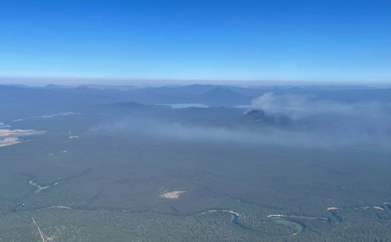
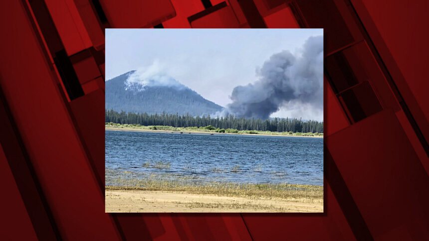
Central Oregon — Firefighters are continuing suppression efforts on the Round Mountain and Wickiup Fires burning on the Deschutes National Forest. The Round Mountain and Wickiup Fires are burning approximately seven miles northwest of La Pine and just north of Wickiup Reservoir. The Central Oregon Type 3 Team is managing both incidents.
Yesterday afternoon, fire activity increased on the Wickiup Fire. Firefighters, dozers and aerial resources were used to slow fire spread. The Wickiup Fire is currently mapped at 200 acres and is 0% contained. Today, firefighters are continuing to make good progress with primary dozer line in places where the fire experienced growth. They are working on the ground and in coordination with aerial resources to cool down hot spots.
Fire activity also increased on the Round Mountain Fire yesterday afternoon. The Round Mountain Fire is currently mapped at 50 acres and is 0% contained. Firefighters are continuing to prioritize keeping the fire as small as possible while also protecting the Round Mountain Lookout and associated infrastructure.
Resources on scene of both incidents include 1 Type 2 initial attack crew, 1 Type 2 crew, 11 engines, 3 dozers, 2 skidgeons, 2 water tenders, and overhead resources. Firefighters on the ground continue to be supported by aerial resources including air attack, single engine air tankers (SEATs), large airtankers and Type 1 helicopters. Both fires are under investigation.
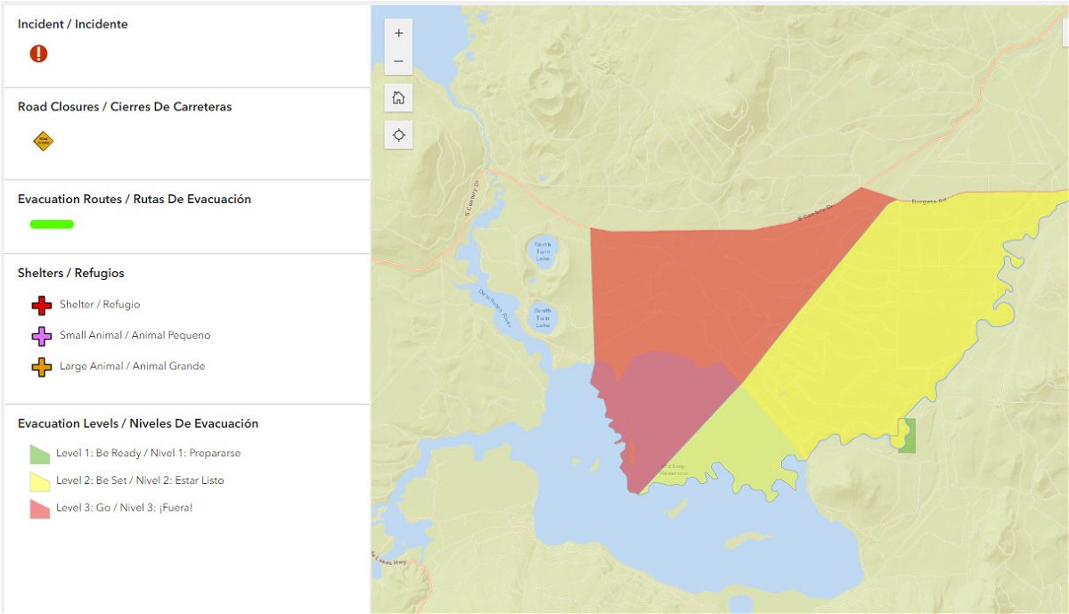
The Deschutes County Sheriff’s Office has issued Level 3 (Go Now), Level 2 (Get Set) and Level 1 (Be Ready) evacuation notices north of Wickiup Reservoir. An interactive map of evacuations is available here:
- Level 3 (Go Now): National Forest area north of Wickiup, Forest Service Road 4262 and Forest Service Road 4380 and south of Forest Service Road 42 (South Century Drive)
- Level 2 (Be Set): National Forest area between Road 4380 and the Deschutes River including Bull Bend and Wyeth Campgrounds and private inholdings along the west side of the river at Haner Park
- Level 1 (Be Ready): Haner Park subdivision east of the Deschutes River
Forest Service Roads 4380, 4260 and 4262 in the vicinity of the Wickiup Fire, are currently barricaded for public and firefighter safety during active fire suppression activities. Forest Service Roads 42 and 43 remain open; however, the public is asked to use caution as firefighters and firefighting traffic are present. The Gull Point and South Twin Lakes areas remain open. Bull Bend and Wyeth Campgrounds and Tenino Boat Launch are currently closed. North Twin Lake Campground remains closed and is being used to support firefighting operations. The incident management team is in coordination with local officials in the event of potential fire growth.
Visit the official source for wildfire information in Central Oregon at centraloregonfire.org for wildfire updates or follow fire information on X/Twitter @CentralORfire. Call 9-1-1 to report a wildfire.
The Deschutes County Sheriff's Office said in a posting around 6 p.m. on its Facebook page it was on scene assisting with evacuations near Wickiup Reservoir.
The La Pine Rural Fire District said crews were working through the night to establish containment lines.
Find the interactive maps at http://www.deschutes.org/emergency. You can also see the Deschutes Alerts and their individual maps and descriptions on this page: https://member.everbridge.net/892807736723736/notif
