Heavy smoke from other blazes helps cool 114,000-acre Falls Fire on Malheur National Forest, now 10% contained
BURNS, Ore. (KTVZ) -- More than 1,600 firefighting personnel trying to stop the 10-day-old, more than 114,000-acre Falls Fire on the Malheur National Forest have been helped the past couple days by heavy smoke from other blazes in the region, reducing wind and temperatures on the lines.
Here's Saturday's update:
Falls Fire Update for July 20, 2024 07-20-2024
Size: 114,236 Start Date: July 10, 2024 Location: 13 Miles NW of Burns, Oregon
Containment: 10% Total Personnel: 1,661 Cause: Human-caused, under investigation
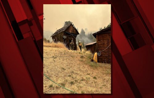
Structures Triaged: Residences: 261; Commercial: 58; Outbuildings: 414
Resources Assigned: 47 hand crews, 105 engines, 27 bulldozers, 32 water tenders
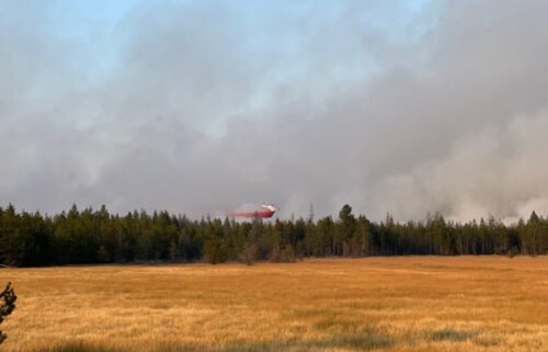
Aerial resources available to the fire: two helicopters, and four single-engine air tankers (SEATs).
https://inciweb.wildfire.gov/incident-information/ormaf-falls-fire
https://www.facebook.com/profile.php?id=61562017027302
Yesterday, for the second consecutive day, fire growth on the Falls Fire was moderated by a persistent heavy smoke layer coming in from other fires in the region keeping wind and temperatures lower over the fire. Night shift and day shift operations have been taking advantage of this opportunity to increase containment and establish direct control lines ahead of the fire. The fire is burning approximately 13 miles north of Burns, 11 miles southwest of Seneca, 7.5 miles south of Izee, and 3 miles west of Highway (Hwy) 395.
A community meeting will be held this afternoon, July 20 at 3 p.m. at the Grant County Regional Airport in John Day. The meeting will be live-streamed on the Malheur National Forest and Falls Fire 2024 Facebook pages.
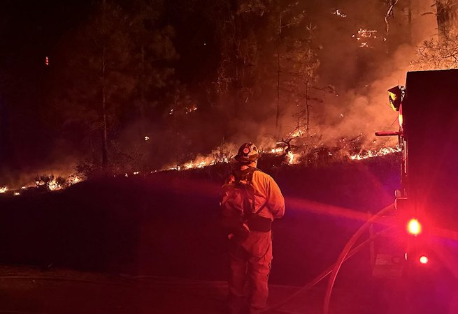
Yesterday evening, a successful tactical burnout operation was conducted in the northeast portion of the fire. The objective was to protect private property to the north, including the Izee area, south of Forest Service Road (FSR) 68 between FSR 4790 road and FSR 47. Oregon State Fire Marshal (OSFM) crews continued to provide point protection to structures, enhance surface preparation, and extend structure surveys along Highway 395, throughout Seneca, Izee, and surrounding areas. Resources continued constructing direct line with dozers and hand crews on FSR 4785 up to Burnt Mountain. Dozers established a contingency (secondary) line along 4781 toward Snow Mountain.
Fire crews and equipment also continued to establish control line along the northern flank of the fire extending along FSR 3750 and connecting up with the northern portions of FSR 37 and FSR 31. In the northeast corner, Crews and dozers worked off the east side of FSR 31 to build line around a 200 acre slop-over, just south of Myrtle Park Meadows, to tie it back into FSR 31. The line is nearly complete and preparations are underway to conduct a small tactical burnout operation within this slop-over area to help secure the control line.
Control lines along much of the south and west portions of the fire, along FSR 43, continue to hold firm as mop-up operations continue. OSFM crews positioned along FSR 31 assisted with mop up and conducted patrols along existing lines. Firefighters also scouted for additional contingency line opportunities. OSFM crews faced active fire behavior and supported efforts to complete fire line East of the 47 road, North of Sugarloaf Mountain and along the southeast edge of the fire.
Today, crews will continue constructing and securing direct dozer line along FSR 4785, as well as an alternative contingency line on FSR 4781 out to Snow Mountain. Along the eastern portion of the northern flank of the fire, dozer and handline will be constructed with the objective of tying in line around Burnt Mountain. Crews and equipment will continue establishing control line along the northern flank of the fire extending along FSR 3750 and connecting toward FSR 37 and FSR 31.
Firefighters are preparing to conduct a series of tactical burnout operations along this road system to secure control lines when conditions are favorable. On the northeastern portion of the fire, just south of Myrtle Park Meadows, work will continue on the two-day old 200 acre slop-over along the FSR 31 Road.
Firefighters will continue to hold, improve, and mop-up control lines along the westerly and southern areas of the fire. In the southeast corner of the fire, work will continue on securing dozer line and mopping-up hotspots in the Red Hill area.
Today, a Red Flag warning is in effect for dry and unstable conditions. Fire weather is predicted to be similar to the past two days – warm, with some terrain-driven (diurnal) wind, being moderated by a persistent heavy smoke layer. These conditions may inhibit fire behavior and help firefighters to make progress on containing the fire. Winds on the fire today will transition starting in the evening from terrain-driven to predominantly easterly (wind coming from the east) with possible gusts up to 18 mph. Temperatures will be in the 90s and relative humidity will be very low. A Heat Advisory is in effect for the area starting today and extending into Monday with temperatures possibly over 100 degrees.
Evacuation notices remain in effect in Grant and Harney Counties. For the most accurate evacuation information, please visit the Harney County Sheriff’s evacuation map here: https://tinyurl.com/3zst4sjy, or the Grant County Emergency Management Facebook page at: https://www.facebook.com/profile.php?id=100068819321423.
The Malheur National Forest issued a fire area closure. A detailed map and additional information about the fire area closure are available at: https://www.fs.usda.gov/detail/malheur/news-events/?cid=FSEPRD1189259.
A temporary flight restriction (TFR) remains in place over the fire area.
U.S. Forest Service fire investigators are seeking the public’s assistance with any tips or information pertinent to the start of the Falls Fire on the Malheur National Forest. Please submit any information that could assist fire investigation efforts to SM.FS.R6TipHotLine@usda.gov.