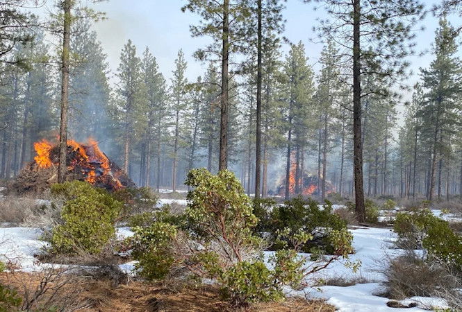
Forest Service plans pile burning this week west of Phil’s Trailhead, south of Skyliners Road, in Wanoga Butte area

BEND, Ore. (KTVZ) — Firefighters across the Bend-Fort Rock Ranger District plan to conduct up to 217 acres of pile burning operations west of Phil’s Trailhead and south of Skyliners Road this week. Additional ignitions are also slated for the Wanoga Butte and Bearwallow Butte areas.
If conditions are favorable, firefighters will conduct ignitions starting Tuesday and lasting through Friday.
No road or trail closures are anticipated; however, smoke will be visible and may impact Ben’s Trail, Ben’s Tie Trail, Kent’s Trail, MTB Trail and Phil’s Trail. Smoke may also be visible from Skyliners Road, and residents in the area are encouraged to keep doors and windows closed to help minimize smoke impacts.
Firefighters select pile burning units for ignition based on moisture levels, forecasted weather and conditions predicted to move smoke away from communities where possible. Piles may smolder, burn, and produce smoke for several days after ignition. Once ignited, firefighters monitor piles until they are declared out. Please do not report ignitions.
While smoke may linger in the area, removing these large accumulations of woody debris during the winter months minimizes fire danger. The piles are concentrations of leftover materials associated with vegetation management activities being done to help maintain and restore forest and ecosystem health while reducing hazardous fuels loading.
What does this mean for you?
Smoke may settle in low-lying areas overnight and in the early morning hours.
- All residents are encouraged to close doors and windows at night to avoid smoke impacts.
- If available, use a portable air cleaner. Air cleaners work best running with doors and windows closed. You can also create a DIY air cleaner.
- If you have a central air system, use it to filter air. Use high-efficiency filters if possible.
- When driving in smoky areas, drivers should slow down, turn on headlights and turn air to recirculating.
- If you have heart or lung disease, asthma, or other chronic conditions, pay attention to how you feel and if symptoms of heart or lung disease worsen, consider contacting your health care professional.
- Go to centraloregonfire.org to learn more about smoke safety in Central Oregon and visit When Smoke is in the Air for more smoke preparedness resources.
For more information visit centraloregonfire.org/ or fs.usda.gov/deschutes and follow us on Twitter @CentralORFire. Text COFIRE to 888-777 to receive prescribed fire text alerts.
This work is occurring within the Central Oregon Landscape, one of 21 focal landscapes identified within the Forest Service’s Wildfire Crisis Strategy. The implementation of this work supports the Deschutes National Forest’s commitment to addressing the Wildfire Crisis Strategy which aims to reduce severity of wildfires, protect communities, and improve the health and resiliency of fire-dependent forests.