NWS survey: Winds to 100 mph caused Culver-Metolius damage, no sign of tornado
Evidence points to 'concentrated swath of extreme straight line winds'
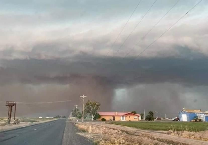
PENDLETON, Ore. (KTVZ) -- A fierce thunderstorm that caused major damage in the Culver and Metolius areas on Saturday afternoon brought "extreme straight line winds" of up to 100 mph, but a National Weather Service survey team said Monday it did not find evidence of a tornado.
Between 12:55 and 3:30 p.m. on Saturday, severe storms
developed across parts of Southern and Central Oregon, the NWS said.
"These storms, propelled by an optimal severe weather environment, brought large hail up to golf ball size, and swaths of damaging winds from Deschutes through southern Wasco counties."
An NWS survey team from Pendleton conducted a storm damage survey on Sunday of the destructive event that occurred in the Culver-Metolius area between 1:45 and 3 p.m. on Saturday, bringing winds of 70-100 mph.
The "concentrated swath of extreme straight line winds" led to "numerous large trees uprooted or snapped, hundreds of yards of irrigation line dislodged and/or mangled, and several snapped or leaning power poles," the NWS statement said.
"Some of the more significant damage included destruction of a handful of agricultural buildings, and partial or total roof removal of at least two manufactured homes. A couple of high-tension power line structures were also affected, with two of the towers partically destroyed," the statement continued.
Despite the intensity of the damage, the survey team found most of the debris was blown either south to north or southwest to northwest.
"This indicates the prevalence of a divergent straight line wind pattern, rather than the circular convergent pattern associated with a tornado," NWS said.
Based on the damage, the weather service estimated wind speeds in the narrow swath from 60-70 mph for the lower-end damage of trees, irrigation lines and outbuildings, to 80-100 mph for the more significant destruction.
For reference, they said, winds within an EF-1 tornado range from 86 to 109 mph.
"Even though no tornado could be confirmed, such intense straight line winds are equally capable of significant and life-threatening damage," the NWS concluded.
