Sisters Ranger District outlines fall prescribed burn plans

Metolius Basin, areas near Hwy. 20-Indian Ford Road deemed critical
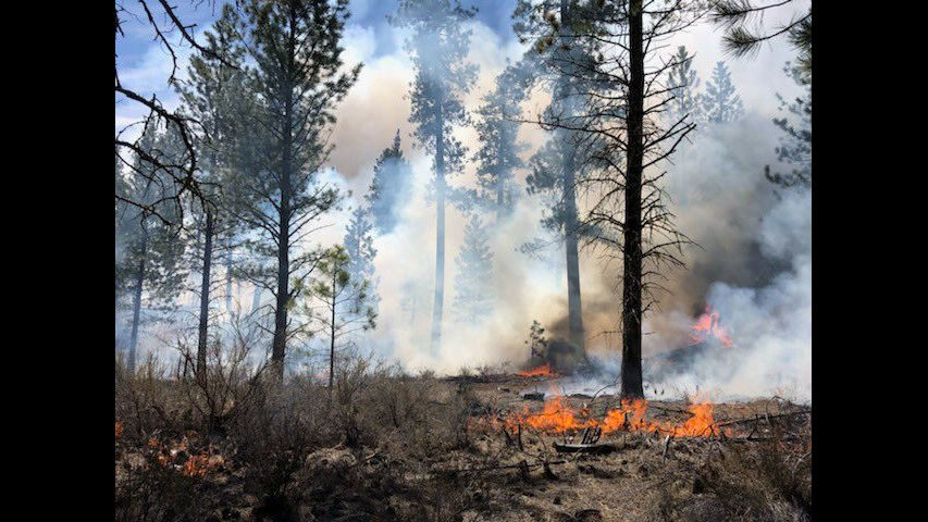
SISTERS, Ore. (KTVZ) -- To reduce the potential for large wildfires, reduce excess vegetation and improve overall forest health, the Sisters Ranger District said Tuesday it plans to conduct prescribed burning activities beginning as early as this week and continuing throughout the fall.
Fuels specialists have identified two critical areas, the Metolius Basin and areas adjacent to the Highway 20 and Indian Ford Road intersection, to do prescribed burning this fall.
The prescribed burns are planned around increased moisture and decreased temperatures. Fire managers expect a limited window of suitable weather.
“Timing of ignitions and exact dates will depend on weather and site-specific fuel moisture conditions. Burning will be conducted under prescribed conditions that allow for safe operations, appropriate levels of burn intensity, and very careful smoke management,” said Andrew Myhra, Sisters Ranger District fuels specialist.
Prescribed burning operations have critical safety components in place and are designed to occur within a combination of natural and constructed control lines. All burns are done under carefully planned prescriptions and protocols to eliminate the risk of an escaped fire and smoke exposure to communities, the Forest Service said.
Fire management officials work with Oregon Department of Forestry smoke specialists to analyze weather conditions and anticipated smoke dispersion to determine burn dates. Individuals with respiratory conditions can request to be placed on an advance contact list by calling the Sisters Ranger District office at 541-549-7700.
Prescribed fire operations in the Metolius Basin may require temporary trail closures on portions of the Metolius-Windigo Trail #99. No road closures are anticipated with any of the burns, although drivers may experience precautionary traffic control on Highway 20 during operations in the Indian Ford area. Drivers may also experience some smoke and reduced visibility along Indian Ford Road (Forest Service Road 1102).
When smoke is present, motorists should reduce speed and turn on headlights. All efforts will be made to limit smoke impacts to area neighborhoods and communities. The possibility exists for smoke to settle in low-lying areas due to cool night-time temperatures. Residents in areas near burn operations are encouraged to close windows at night to avoid possible smoke impacts.
For current wildfire and prescribed fire information follow us on Twitter @CentralORFire or visit centraloregonfire.org. Confirmed prescribed fire dates and locations will be listed on these platforms.


