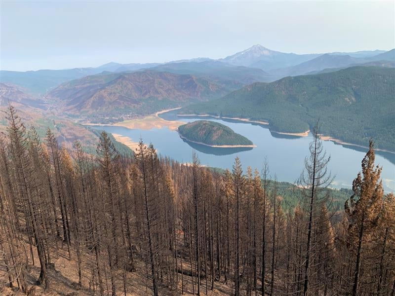
‘There’s a lot of work getting done’: Lionshead Fire reaches 43% containment
WARM SPRINGS, Ore. (KTVZ) -- More progress was reported Saturday on the Lionshead Fire that has burned more than 204,000 acres since mid-August, but the Confederated Tribes of Warm Springs have barred hunting in the fire zone due to safety issues.
| Start date: Aug. 16, 2020 | Containment: 43% | facebook.com/LionsheadFire |
| Fire size: 204,378 acres | Public information: 971-277-5075 | https://inciweb.nwcg.gov/incident/7049/ |
Confederated Tribes of Warm Springs Lionshead Fire Update
Saturday, Oct. 3
REDMOND, Ore. – Firefighters’ energy and morale are high all around the 328-mile perimeter of the Lionshead Fire, fire managers reported Friday.
“We are in a good rhythm,” said John Spencer, operations chief trainee. “There’s a lot of work getting done.”
On Friday, tribal leadership enacted a closure order barring tribal members from hunting in the fire zone for their safety and that of firefighters.
“It’s just not safe out there right now,” said Bobby Brunoe, general manager of natural resources for CTWS, listing active burning in the interior, hazard trees and large equipment and fire traffic in and around the area as the primary concerns leading to the decision.
A considerable amount of black line was completed around the southwest corner of the fire. Work will continue today to reinforce those lines; fallers cleared an additional two miles of Hwy. 46; and assessment began of the damaged powerline system on the reservation. To the northwest, a spot fire was contained in the “finger,” and crews continue to identify and extinguish hot spots.
In the interior, the fire continues to burn actively. To the northeast, previously unburned fuel pockets within the interior are being consumed, with occasional single tree burning, called torching. Although fire progression is slow, there is still a significant amount of fuel available to burn. Needle cast and leaf fall are adding new fuels to burned and unburned areas across the fire footprint as well.
Aviation is still providing water support on the southwest corner and also coordinated a flight to assess Oregon Department of Forestry-protected timberlands. Crews expect to finish work in the Stahlman Cabins area
Winds will be out of the northwest at 10 mph today and 15 mph Sunday, with gusts up to 23 mph. This could stimulate active burning in other areas of the fire, but significantly increases the risk to firefighters in another way -- falling trees are a leading cause of death in hazard areas. At times, crews may have to stop work and seek shelter.
Weather: High temperatures will be around 80 today, drop to 70 Sunday, then settle into the mid-70s Monday-Wednesday.
Evacuations and Closures: Breitenbush Hot Springs remains at Level 3 – “Go!” Detroit, Idanha, Hwy. 22 east of Detroit Dam to milepost 56, and Opal Creek Wilderness/Jawbone Flats are at Level 2 – “Be Set.” Elkhorn, Gates east of Gates Hill Road, and Hwy. 22 from Gates Hill Road east to Detroit Dam are at Level 1 – “Ready.” Residents of Linn County can find up to date information at www.LinnSheriff.org. Closure orders and maps can be found at https://inciweb.nwcg.gov/incident/7049/
Holiday Farm Fire Update, October 2
Springfield, Ore. Firefighters continue to make steady progress on the Holiday Farm Fire. The fire remains in the same foot print and has burned 173,094 acres. Containment has reached 70%.
Firefighters continue to detect and extinguish hot spots near the fire perimeter. They are methodically working inward to ensure that all hot spots and potential threats to the containment line have been mitigated. This patrol and mop up work will be the focus for many of our firefighters for several days.
With hunting season beginning again, fire managers would like to remind people of the area closures. The fire area continues to have a presence of firefighters and heavy equipment and should be avoided. These areas will remain closed indefinitely until all of the land managers can determine the extent of the fire effects.
Information for the Willamette National Forest can be found at: https://www.fs.usda.gov/main/willamette/fire
Information on Bureau of Land Management closures can be found at: https://www.blm.gov/alert/fire-closures-and-fire-restrictions
Highway 126 will be open for travel on Friday beginning at noon. ODOT is encouraging through traffic to plan for alternate routes, as there will still be recovery work occurring and hazards still exist along the roadway. Anyone traveling the highway should plan for lengthy delays as crews are still working on the recovery effort. The speed limit for the highway through the fire area has been reduced to 45 mph. Extra patrols will be present to enforce this lowered speed limit. For information related to road closures and delays, please visit: www.tripcheck.com or https://www.oregon.gov/odot/Pages/Wildfire.aspx
Weather today will be slightly cooler as the upper level ridge moves to the east. Over the weekend, relative humidity recoveries are predicted to be higher. These conditions will be helpful for firefighters as they continue mopping up.
For fire information inquiries, call (541) 357-9729 or visit https://inciweb.nwcg.gov/incident/7170/. The Holiday Farm Fire Facebook page will also continue with updates (holidayfarmfire@facebook.com).
Beachie Creek Fire & Riverside Update, October 2
| Riverside Fire Quick Facts Approx. Size: 138,085 ac. | Beachie Creek Fire Quick Facts Approx. Size: 192,882 ac. |
| Containment: 54% | Containment: 59% |
| Total Personnel: 440 | Total Personnel: 395 |
| Start Date: Sept. 8, 2020 Cause: Unknown | Start Date: August 16, 2020 Cause: Under Investigation |
Weather and Fire Behavior: Smoke from California along with stagnant air are causing the foggy and hazy conditions and more smoke visible at lower elevations. Marine air is producing some fog, but it is expected to clear as the day progresses. Temperatures are likely to remain around the high 70’s to low 80’s. Fire behavior will likely be minimal and consist of smoldering and some creeping.
Riverside Fire: Firefighters continued checking for heat and mopping-up around residential areas. Suppression repair work is ongoing as future repair needs are being assessed. Aerial bucket water drops were done around the Ripplebrook area and there were no 9-1-1 calls reporting smoke or hot spots. There has been a significant reduction in fire activity, but efforts will still stay focused on checking for heat and connecting dozer lines with handlines. Crews are identifying areas to be mopped-up and suppression repair work needing to be completed.
Beachie Creek Fire: On the southern perimeter, firefighters are working from east to west with hand held infrared devices to detect and extinguish areas of heat. Suppression repair work continued with the help of Resource Advisors. Firefighters responded to 9-1-1 calls reporting smoke within the fire perimeter, but the number of calls were down from the previous day. Additional efforts on the fire included road grading work and cold trailing. Cold trailing is physically walking and feeling by hand the edge of the fire area where active fire stopped and checking that smoldering is entirely cold and out. Firefighters will continue patrol, monitor, and mop-up operations in areas of need. Suppression repair in the Molalla area is ongoing. Where excavators cannot be utilized, crews will stabilize slopes and spread vegetation by hand.
Riverside Fire Information Officer
Email: 2020.riverside@firenet.gov
Riverside Fire Info: inciweb.nwcg.gov/incident/7174/
Phone: 509-228-7805 (public)
Facebook: facebook.com/RiversideFireInfo
Twitter: twitter.com/fire_riverside Tags: #RiversideFire #ClackamasWildfires
Real-time evacuation updates at: https://twitter.com/ClackCoSheriff and https://www.clackamas.us/wildfires
