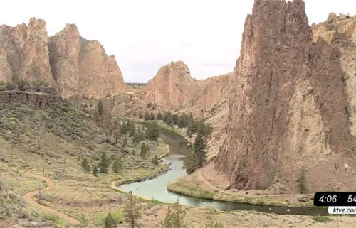
Central Oregon has seen 325 wildfires this year, burning 550,000 acres; 2 new fires near Madras, Tumalo stopped small
BEND, Ore. (KTVZ) – Central Oregon has seen about 325 wildfires this year that have burned over 550,000 acres, the region’s fire officials said Saturday – and fire season isn’t over, as two fires, each stopped at about two acres near Tumalo and Madras, made clear.
Saturday’s first blaze was a brush fire reported around noon west of Madras on private property in the 800 block of Southwest Belmont Lane, near Sunrise Street, according to Kasey Skaar of Jefferson County Fire & EMS.
The fire burned in grass, juniper and sagebrush, and the cause is under investigation. The Central Oregon Interagency Dispatch sent a BLM crew, and an Oregon Department of Forestry engine crew also assisted at the scene, Skaar said.
Some homes were threatened by the fire, but firefighters prevented any damage, and there were no injuries, Skaar said.
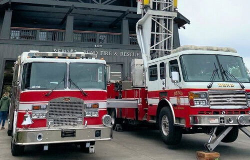
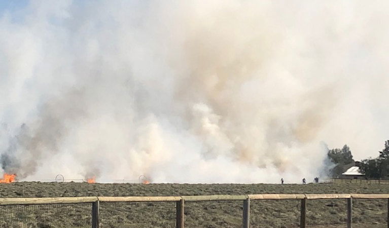
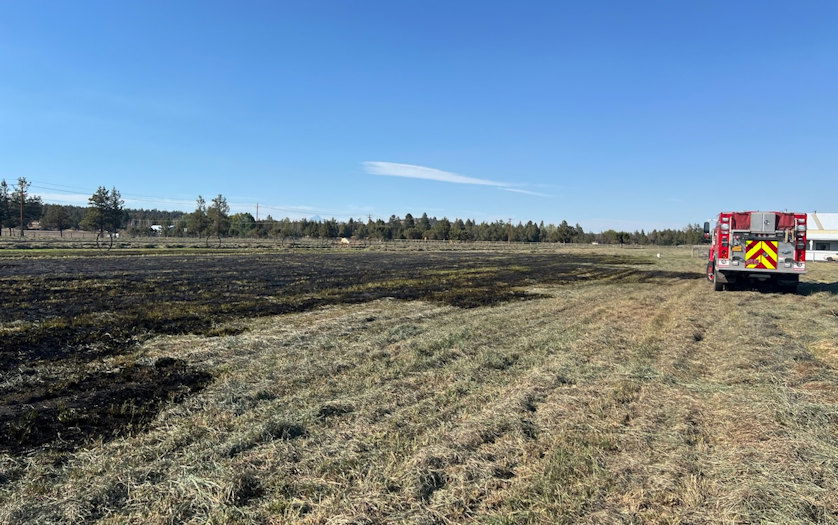
Another fire broke out north of Tumalo shortly before 3 p.m. in the 65000 block of Gerking Market Road, in a hay field at the southeast corner of the intersection with Connarn Road, according to Bend Fire & Rescue Deputy Fire Marshal Cindy Kettering.
In this case, the cause was traced to a bale wagon that lost its brace, and a hot piece of equipment dropped onto the hay, Kettering said.
The fire was pushed south by the wind on a day when the Bend-area temperature reached 90 degrees. Kettering said it was contained to a narrow strip of land on one property. It threatened a pole barn, but firefighters, including mutual aid from Cloverdale Fire, kept it from reaching the barn.
A total of 323 wildfires have been reported in the region through last Tuesday, 193 of which were human-caused and 130 sparked by lightning, officials said. The human-caused fires burned nearly 195,000 acres, while lightning-caused blazes blackened nearly 357,000 acres across Forest Service, BLM and state Department of Forestry-protected land.
Oregon overall has seen some 2,000 wildfires that have burned close to 2 million acres, according to the Oregon Department of Forestry
“Take care with every ignition source!” Central Oregonfire officials advised.
--
Final Fire Update for Willamette Complex North
Boulder Creek, Ore, Linton Creek, and 374 Fires
Saturday, September 28, 2024
InciWeb: https://inciweb.wildfire.gov/incident-information/orwif-north-willamette-complex
Willamette Complex North Facebook Page: https://www.facebook.com/profile.php?id=61565845313387
Email:2024.WillametteComplex.North@firenet.gov
Overview: Today is Northern Rockies Incident Management Team 6’s final day on the Willamette Complex North. A Type 3 team is joining Team 6 today and both teams are working towards a smooth transition. The Type 3 team takes command of the Willamette Complex North today, Saturday at 6pm. Team 6 was honored to work on the Willamette Complex and is grateful for the support from the communities surrounding the fire areas.
Weather forecasts call for continued warm and dry weather through the weekend. Despite this, fire activity is expected to remain moderate to minimal with smoldering and creeping. An increase in smoke production is possible, particularly in areas on southern aspects and full sun exposure. Those fires that are not yet at full containment are expected to remain in the current footprints.
Boulder Creek: 523 acres, 51% contained
Located 5 miles east of McKenzie Bridge. Crews continue to locate and extinguish areas of heat and are felling fire-damaged trees along containment lines. Firefighters are engaged in mopping up and fire suppression repair work, identifying and removing excess equipment.
Ore: 3,479 acres, 100% contained
Located 7 miles northeast of Blue River. Firefighters saw a moderate increase in fire activity within the containment lines in the unburned area in the northwest corner of the fire. On the interior of the fire area, fire was observed slowing backing downhill, remaining within the fire footprint. Crews continue suppression repair work.
374: 62 acres, 0% contained and Linton Creek: 1,309 acres, 0% contained
Located in the Three Sisters Wilderness. These fires were monitored by air on Friday and minimal fire activity was observed. These fires have remained in their footprints adjacent to natural barriers and previous fire scars. Both fires will continue to be in a monitoring status, with no additional action needed at this time.
Pyramid: 100% contained
On Friday, September 27, 2024, Northern Rockies Incident Management Team 6 transitioned the Pyramid Fire to a Type 4 organization with the Willamette National Forest.
Willamette National Forest Area Closures: Forest officials are continually evaluating closure orders and will adjust as conditions allow. Fire-related closures remain in place on the McKenzie River Ranger District, as well as on the Middle Fork Ranger District in the immediate fire operations area for public and firefighter safety. Please respect and avoid all closed areas of the national forest.
Source: https://www.fs.usda.gov/detail/willamette/fire/?cid=fseprd552029.
Road Closures: OR-242 remains closed to all traffic between the intersection with OR-126 and the Dee Wright Observatory (mileposts 55 to 75). For current road conditions, please check Oregon Department of Transportation’s website: https://www.tripcheck.com/.
Related Links:
--
Willamette Complex South & Red Fire Update
Red, 208, Moss Mountain, Coffee Pot, Tire Mountain, McKinley Creek and Chalk Fires
Date: Saturday, September 28, 2024 Fire Causes: Lightning
Email: 2024.willamettecomplex@firenet.gov Information Phone Line: 541-208-1742
Willamette Complex South: Total Personnel:491| Total Willamette Complex South Acres: 23,564
InciWeb: https://inciweb.wildfire.gov/incident-information/orwif-willamette-complex-fires-south
Facebook: https://www.facebook.com/WillametteComplexFires/
Red Fire: Total Personnel: 73 | Total Red Fire Acres: 2,024
InciWeb: https://inciweb.wildfire.gov/incident-information/ordef-red-fire
Facebook: https://www.facebook.com/2024RedFireOR/
Summary
Changing conditions warranted a reallocation and repositioning of resources to maximize impact and efficiency on these fires. Firefighters continue their focus on monitoring and suppression efforts. The influx of warmer, drier air will ultimately result in steadily dropping humidity. Crews are repairing forest roads and finalizing removal of woody debris from indirect firelines. The Chalk, Coffee Pot, McKinley Creek and Tire Mountain fires are 100% contained. Any hot spots are occurring well inside the perimeter, and fire personnel are now seeding shaded fuel breaks with fescue and Mountain Bear grass to rehabilitate firelines.
Road repair crews are clearing ditches and culverts to facilitate proper drainage before grading road surfaces and repairing dozer lines. Some workers and heavy equipment were reassigned from the Chalk and Coffee Pot fires to the Roads Group to aid in that effort. The Incident Management Team has begun decreasing resources per updated operational needs.
Red Fire (1,961 acres, 11% containment)
The fire is creeping down toward Crescent Lake, and will be on the landscape until a season-ending event. The current containment of 11% on the Red Fire is based on cold sections of the fireline going north on the Pacific Crest Trail, along the west side of the fire. As the fire creeps to the south toward Crescent Lake and meets the shaded fuel break built along Forest Service Road (FSR) 60, this percentage will increase. Percentage of fire contained is based on how much of the current fire perimeter has a control-line directly on it, and is stopping fire spread. As this number is a percentage of the total fire perimeter, it may fluctuate as the fire grows and an additional control line is secured around the fire. Firing operations may occur on the south end of the fire today to clean up where the fire’s edge meets the fuel break and FSR 60. Firing plans have been updated and reviewed regularly for the past several weeks to ensure firefighter safety and protect the community and critical resources. As a result, additional smoke may be visible today.
208 Fire (9,045 acres, 4% containment)
Chipping operations and “mop-up” continues on indirect lines surrounding the fire as crews near completion of this work. Much of that is happening on the west side near the Sierra Pacific Industries timberland and along the 2149 Road. Firefighters also continue frequent monitoring of the northwest corner of the fire in the Swift Creek area.
Moss Mountain Fire (2,186 acres, 10% containment)
Fuel reduction operations near the Wolf Mountain Communications site are nearing completion. Heavy equipment continues working in that critical area. Crews expect to finish repairs on the 23 Road soon. Air operations will resume as necessary. The weather forecast means favorable flight conditions for the next several days.
Weather and Fire Behavior
Milder, fall-like conditions are expected for the next several days. Temperatures are predicted to reach the upper-60s to low-70, as much as ten degrees above the seasonal average. The air will give way to increasingly dry, and the relative humidity will likely drop to 40% or less, perhaps as low as 30% in the early part of next week. Lower relative humidity could result in a change in fire behavior.
Closures, Fire Restrictions, and Evacuation
For closure information, visit: https://tinyurl.com/RedFireClosures2024 & https://tinyurl.com/WillFireClosures2024.
For fire restrictions, visit: https://tinyurl.com/DesFireRestrictions2024 & https://tinyurl.com/WillFireRestrictions2024.
The Level 1 – BE READY to Evacuate notice remains in effect for the Red Fire. For more information or to sign up for alerts, visit: www.klamathcounty.org/300/emergency-management.
Public Information
Willamette Complex – South
Eastern Area Complex Incident Management Team
Public Information Line: 541-208-1742, 8 a.m. – 8 p.m.
--
Rail Ridge Fire
Saturday, Sept. 28, 2024
Acres: 165,586 – Containment: 74% – Detection Date: Sept 2, 2024 – Cause: Lightning – Total resources: 1,189
Operational Update:
Yesterday, warmer and dryer conditions contributed to a small increase in acreage on the Rail Ridge Fire. The fire has crossed Black Canyon Creek and is estimated to have consumed approximately 150 acres on the south side of the creek. Smoke was observed in the headwaters of Black Canyon Creek yesterday, which provided a barrier for direct sunlight, moderating fire behavior. A possible increase in fire activity is expected today with warmer temperatures and forecasted winds gusting up to 25MPH. The fire continued to back and flank west along Coffee Pot Ridge. Firefighters used strategic application of fire to bring the fire edges together to create black line. These firing operations were supported by helicopters that provided water bucket drops to hotshot crews working on the ground. As days get shorter, shading in the canyon creates a shorter burn window when the fire is influenced by direct sunlight. Firefighters will continue to hotspot, cold trail, and mop up areas of heat in the northwestern portion of the fire in the Black Canyon Wilderness as well as the northeast side, where they continue to gain containment, and shift into suppression repair work.
Wiley Flat Fire
Acres: 30,186 – Containment: 94% – Detection Date: Sept 2, 2024 – Cause: Lightning – Total resources: 49
Operational Update: Suppression repair efforts will continue today as fire crews work towards full containment.
Weather
Gusty winds are expected today across the fire area, transitioning from the south to the southwest, and northwest on the ridges. Gusts up to 20-25MPH with lower humidities and temperatures in the mid 80’s.
Evacuations
Rail Ridge Evacuations: Level 1 and 2 evacuation zones for the Rail Ridge Fire remain in Grant County.
Wiley Flat Evacuations: Level 2 and 3 evacuation zones are in place for the Wiley Flat Fire in Crook County.
For Current Evacuation Levels in Wheeler, Crook and Grant counties, please visit: https://linktr.ee/RailRidgeFire
Closures
The U.S. Forest Service and Bureau of Land Management have implemented closures for the Rail Ridge and Wiley Flat Fires. For more details and closure maps, visit https://linktr.ee/RailRidgeFire