Much of High Desert gets blue-skies break between storms, but more snow expected
(Update: Adding forecast update Thursday school closures, delays)
BEND, Ore. (KTVZ) -- Wednesday’s snowfall and slick roads led to a few school closures and delays Thursday around the High Desert, and forecasters said a blue-sky break between storms would end later in the day.
The Sisters School District closed for the day, while Jefferson County 509J and Culver schools were on a two-hour delay.
While Thursday morning dawned with blue skies for much of the region, the National Weather Service extended its winter weather warning for Central Oregon to 4 a.m. Friday and said another 2-4 inches of snow are expected Thursday afternoon and night.
Steady snowfall returned to a wide area of the High Desert and the state on Wednesday morning and quickly began to accumulate around Central Oregon, leading to several crashes being reported on highways around the region and early closure of Central Oregon Community College campuses.
Due to inclement weather and worsening road conditions, all COCC campuses closed at 5 p.m. Wednesday. All COCC classes and events, including remote/online, that are scheduled to start at or after 5 p.m. were canceled. The early closure included both on-campus and remote personnel. The scheduled monthly COCC Board of Directors' meeting moved to a Zoom-only format.
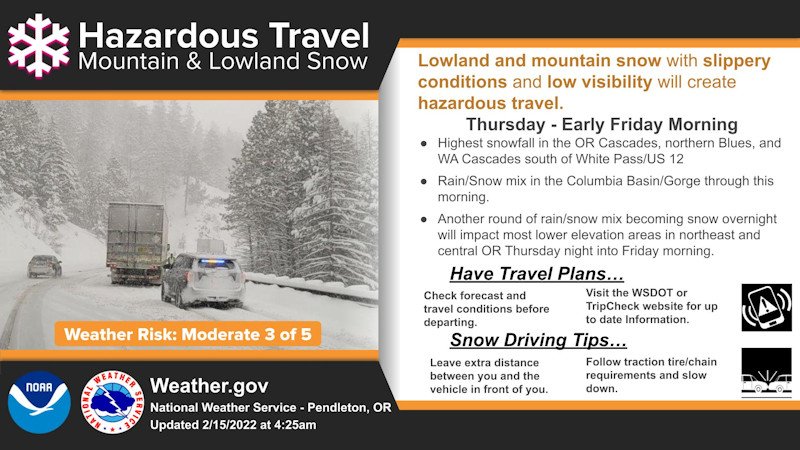
The National Weather Service in Pendleton had issued a winter weather advisory for Central Oregon for 4 a.m. Wednesday to 10 a.m. Thursday and predicted 1-3 inches of wet snow. The snow began to fall and stick at mid-morning in Bend, and close to that three inches already had piled up by mid-afternoon, when it was still falling. Forecasters said another 1-3 inches was possible.
A weather spotter reported 3 1/2 inches of snow between 10 a.m. and 1:30 p.m. and the snow was still falling. Another spotter in the Camp Sherman area reported four inches so far. And a weather spotter near Madras reported five inches of snow by early evening.
Far more snow was predicted at higher elevations, as a winter storm warning was posted for the east slopes of the Cascades, ranging from 10-20 inches at higher elevations, locally heavier along the crests and passes, to 3-6 inches from La Pine and Sunriver to Sisters and Camp Sherman.
“Plan on slippery road conditions,” forecasters said, advising to “slow down and use caution while traveling.” You can check the latest road and weather conditions at our TripCheck page.
For the north Oregon Cascades, the winter storm warning extends to 10 p.m. Thursday for another 18 inches of snow, but up to 30 inches near Mount Hood, with winds gusting to 35 mph, making for "very difficult" travel, forecasters said.
On Wednesday evening, while the Central Oregon advisory wasn't extended then, the NWS extended winter storm warnings to 4 a.m. Friday.
"We can call this the Valentine's Day storm of 2024," NewsChannel 21 Chief Meteorologist John Carroll said in his online forecast, warning of potentially icy roads and tricky travel, even black ice if temperatures warm, then freeze again overnight. He also said temperatures mean wet, heavy snow could lead to downed limbs and power outages.
Around Central Oregon, Jackknifed semi-trucks, rollover crashes and other incidents were reported on several highways. There were no reports of severe injuries.
While the Redmond, Bend, Madras and Prineville airports reported snow at 2 p.m. and temperatures at or near freezing, Sunriver had mixed precipitation and TripCheck road cameras showed temperatures above freezing at mid-afternoon.
Meanwhile, Multnomah County officials said they will declare a state of emergency Wednesday evening due to potential snow.
Up to 3 inches of snow could fall in the Portland area Wednesday night through Thursday afternoon, according to the National Weather Service. Wind gusts of up to 40 mph were also included in the forecast.
Four severe weather shelters will be opened in the county from 8 p.m. Wednesday through at least 10 a.m. Thursday, officials said, adding they were prepared to keep shelters open past that time based on conditions. Beds will also be temporarily added at an existing year-round shelter in Portland.
Authorities said they were ramping up outreach to the thousands of people who live outside in the region and distributing cold weather gear.
Snow and severe winter weather have paralyzed Portland in the past. The city, which is more used to rain, only treats about a third of its street grid in the event of snow and ice and does not plow side streets.
Winter weather in the region can also prove deadly. Last month, snow, freezing rain, ice and frigid temperatures were blamed for at least 10 deaths in Oregon from hypothermia and falling trees or utility poles.

