Persistent pattern of heat and dry conditions through next week increases fire concerns

Bend, Ore (KTVZ) – The dry and well above normal conditions will continue over the weekend and into next week. The normal high for mid-July is around the low to middle 80s, and our afternoon highs will reach near 90 or above through the middle of next week.
The dry and hot weather only increases the threat of rapid wildfire spread if a fire starts. Be aware of all burn bans and restrictions.

The latest Drought Monitor has been released and there is not good new for Central Oregon. The Extreme Drought Category has expanded now to include a good section of Jefferson County and higher coverage in Deschutes and Crook Counties.
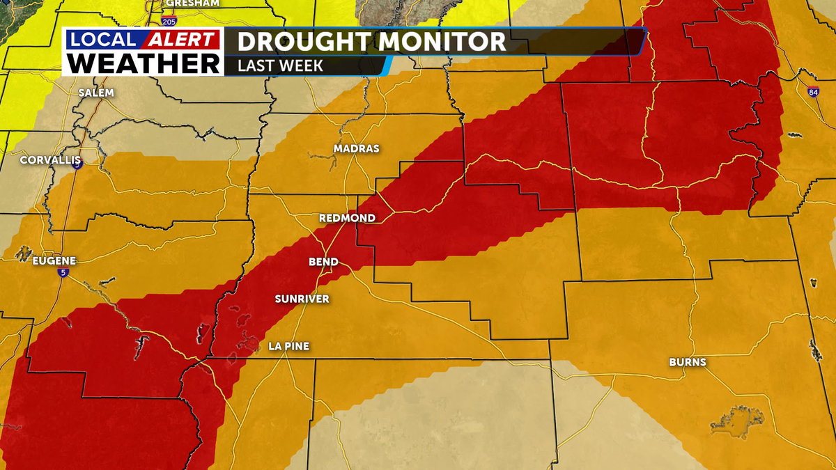
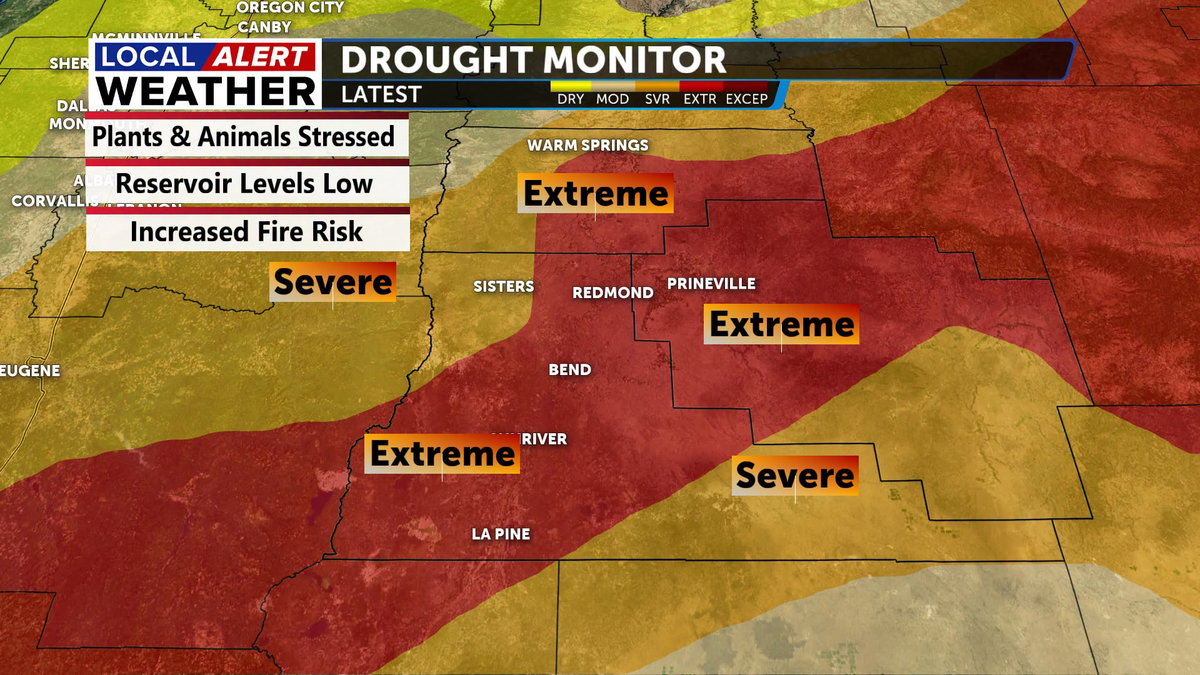
Deschutes County went from 30% last week to 60% coverage this week. Crook County was at 50% last week and is now at 67% while Jefferson went from 5% to 45% with respect to the extreme conditions. Water levels in reservoirs are low and being managed to restrict usage to conserve water. Crops are impacted as well as the fire danger that persists.
The long-term prognosis of the drought is that it will persist for at least the near term. The forecast is not favorable for any improvement as we are going to continue our dry and hot weather conditions though the next week or more.
Friday and Saturday will see the mercury rise to near 90 both days in Bend and just a few degrees below in Redmond. Sunday may be a degree or two lower, but still in the upper 80s under mostly sunny to partly cloudy skies.
Monday through Wednesday will be in the 90s as the huge ridge of high pressure in the middle of the country expands west. There is a cool pool of air trying to drop into the Pacific Northwest from the Gulf of Alaska, but that will not make it this far south.
Monday we may see a passing shower as some moisture rides around the periphery of the ridge, but nothing substantial. By Tuesday a weak low off the coast that will provide some moisture to the region, but very little. This will only be able to provide just enough moisture to our area that isolated storms may develop in the heat of the day Tuesday and Wednesday.
Our dry pattern is likely to continue into next weekend as well.
Please, Stay safe and smart.
Don’t forget to download the Local Alert Weather App to stay connected with our team of meteorologists.
You can get access to LIVE radar and receive urgent weather alerts so you’re always prepared.
