Snow Report: December 13, AM
Snow will continue to accumulate along the Cascades over the next few days. Ski Bowl remains closed until further notice.
Continue ReadingSnow will continue to accumulate along the Cascades over the next few days. Ski Bowl remains closed until further notice.
Continue Reading
The National Weather Service released a Winter Weather Advisory for west and south portions of the region. It will last from 4pm tonight to 10am Saturday morning. This is due to the snow and mix expected today that will create some hazardous driving conditions. Roads will be slick out there once again. Snow is still
Continue Reading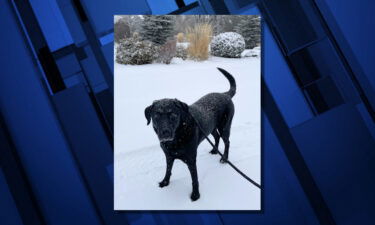
The first significant snowfall this winter arrived early Thursday across the lower elevations of Central Oregon, bringing two or more inches in some areas and making for slick roadways and crashes.
Continue ReadingThe snow has returned to the Cascades and there will be plenty more on the way as we head into the weekend. All locations are reporting snow, the only issues today will be the roads to the resorts. This will be the problem Friday and Saturday as there will be off and on snow showers
Continue Reading
There will be a series of fronts that will slide through the state that will provide the area with mountain snow and lower elevation snow and wintry mix. The snow will be slow and steady and will be returning to the region Friday afternoon. The snow today will be tapering off and we may see
Continue ReadingMountain snow will continue into the weekend. Upwards of a foot of snow is expected by Sunday.
Continue Reading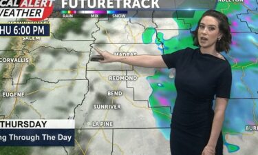
Rain and snow began last night and have continued in some areas through the night. You are likely waking up to white yards or wet roads. Either way, roads will be slick on your morning commute so drive carefully. Temperatures today will be on the chilly side, only reaching the upper 30s. Lows tonight in
Continue Reading
June provided the weather forecast for the region Wednesday as we prepare for some snowy conditions. June is in sixth grade at Obsidian Middle School in Redmond and enjoys studying ELA, which stands for English, language and arts. This will be a big help in the future, if she decides to become a journalist, as
Continue ReadingEnjoy the new snow this week as several inches of snow are forecast to arrive. Starting late on Wednesday and into Thursday the first in a series of snow events will arrive. The snow lingers early Thursday then followed by a bit of sun and mostly clouds. More snow arrives late Friday and into Saturday.
Continue Reading
A series of fronts will cross the region opening the door for plenty of wet weather. The waves of rain and snow will be light with each passing and the temperatures support a mix of mostly rain and some snow during the day, but snow at night. There will be breaks in the pattern with
Continue ReadingWe are entering a wet pattern with lots of new snowfall in the forecast over the next few days. Hoodoo has opened again through the weekend.
Continue Reading
Starting tonight, rain and snow will move in with an incoming low pressure system and an occluded front. This is the second system out of about four that are impacting us over the next week. The high desert will see a periods of snow, rain, and wintry mix as each system passes. We could see
Continue Reading
There will be a series of low pressure systems pushing in from the eastern Pacific over the next several days. The result will be periods of rain and snow over the high desert, with several inches of snow on the Cascades by the end of the weekend. The High Desert will see off and on
Continue ReadingAnother bluebird day as the mountains are bathed in sunshine and the temps are around freezing. There is no new snow to report, but more is on the way. There will be several days with new snow starting tomorrow. Snowfall will begin late Wednesday afternoon and we should see off and on snow through at
Continue ReadingWe remain dry today but snow is in the short term forecast. An approaching wet pattern should provide us with plenty of fresh pow.
Continue Reading
Temperatures today will range from the low to mid 40s after a bit of a chilly start. Skies will be partly cloudy and increase overnight but we will remain dry. Lows tonight will be in the teens and 20s. Temperatures this week remain pretty consistent.The ridge of high pressure overhead has kept us dry and
Continue Reading
The weather pattern for the next couple of days will be chilly and dry as the region is under the influence of an area of high pressure. This will keep the area mostly sunny and crisp in the afternoon and clear and cold overnight. The temperature to start the week will be about normal for
Continue ReadingAnother “bluebird day” as the skies are mostly sunny and the temps are crisp. There are reports of new snow on Meadows, Timberline and Hoodoo the past 24 hours, and more is on the way over the weekend. The next chance for some snow will be late Wednesday into Thursday then off and on each
Continue ReadingThe Cascades got a few new inches of snow over the weekend. More snow is in the forecast later this week.
Continue Reading
Temperatures today will top out in the 30s and 40s under mostly sunny skies. We could see some patchy fog this morning. Lows tonight will be cold, dropping into the single digits for some while others hover in the teens and low 20s.Temperatures will be in the 40s for the majority of the week, with
Continue Reading