Evacuation levels lowered after 78-acre Mile Marker 132 Fire; TDS repair crews work to restore Redmond-area TV/internet
(Update: Evacuation levels reduced; TDS crews making repairs, some areas still out of service)
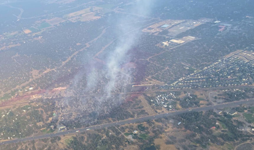
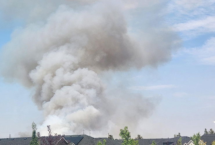
BEND, Ore. (KTVZ) – Two days after a fast-moving brush fire on Bend's northern outskirts sent up thick, billowing smoke and brought a major ground and air attack that stopped its advance, the widespread impacts were easing Sunday as authorities reduced evacuation levels and repair crews restored some TV and Internet service to the north, in Redmond.
The Mile Marker 132 Fire triggered widespread evacuations of hundreds of homes and a power outage that contributed to major traffic jams.
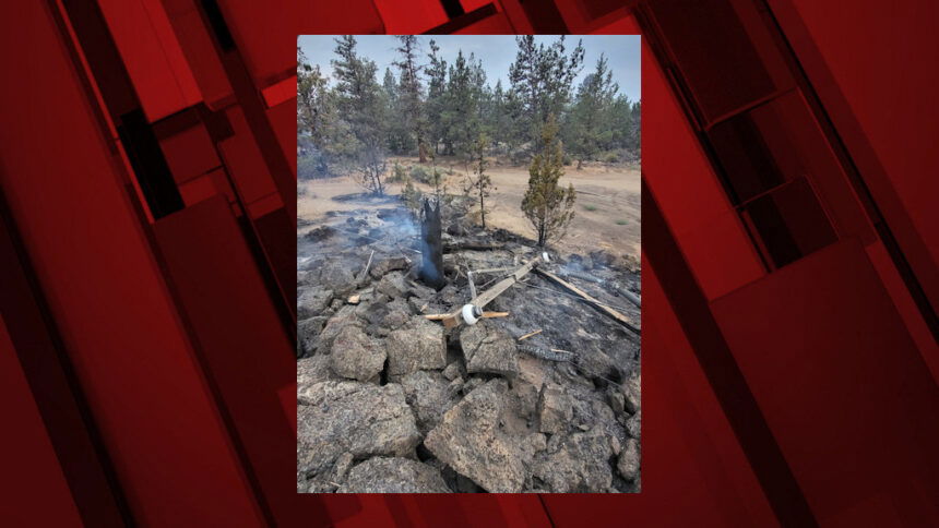
But by nightfall, firefighters had a line around the blaze, keeping it from spreading from the Juniper Ridge area to reach the mobile home parks and neighborhoods nearby. On Saturday, it was mapped by GPS at 78 acres, and declared 100% contained.
"We had crews on the fire all night long, and so they were working on the containment level," Bend Fire & Rescue Deputy Chief of Administration Trish Connolly said Saturday afternoon.
"We just got it to 100% (containment), which is tremendous," Connolly said. " So it means they tied in all of that line. They're working on hotspots, so they work from the perimeter to the interior, working hot spots on the fire."
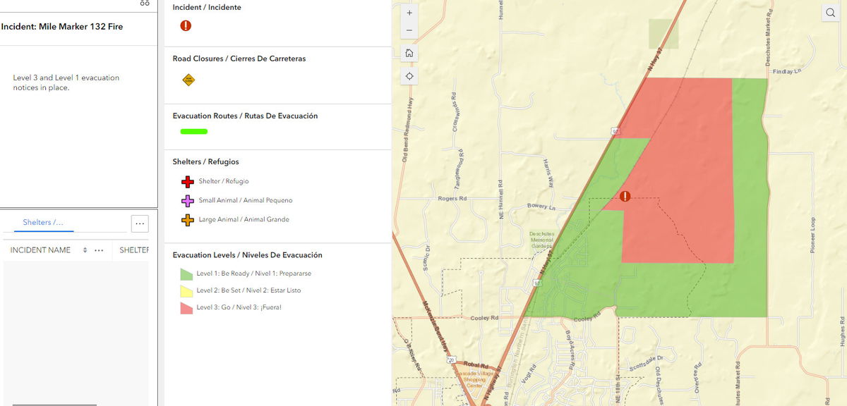
Deschutes County Sheriff's Office released and updated maps of evacuation levels, including an initial large Level 1 BE READY, then Level 3 GO NOW evacuation. Deputies and Bend Police moved quickly to get people out of harm's way.
Sgt. Nathan Garibay, the sheriff's office emergency manager, said Saturday, "Evacuations included both residences and residential areas, as well as commercial and as well as mobile home parks. We did also evacuate a number of unhoused population that were living in the encampments in Juniper Ridge."
"The important thing to remember is, as we have quite a bit of summer left, and really encourage people to make sure that their homes are prepared, that they're signed up for alerts," Garibay added. The likelihood of additional fires in Central Oregon is real."
The fire did not destroy any structures but had other widespread impacts, from a major TV and internet outage in the Redmond area to a power outage that shut down a hydro plant and cut water service to some Central Oregon Irrigation District customers.
TDS customers in Redmond and Eagle Crest lost service for over a day due to damage to its transmission poles and fiber-optic lines from the fire north of Bend.
TDS spokesman Mark Schaaf told NewsChannel 21 on Sunday, "We have restored service in the Redmond area thanks to the hard work of our field services team after the fire burned a portion of our fiber network and destroyed several retransmission poles."
However, some Eagle Crest residents said their service still had not been restored on Sunday, 48 hours after the fire began.
Schaaf told us, "We are aware of some scattered issues in parts of our service area caused by the fire and are working to resolve. In Pronghorn (now Juniper Preserve), we are working with the utility company on a power issue and expect to resume service there by tomorrow (Monday). Residents in other areas (like Eagle Crest) who are still experiencing service disruption should give us a call at 844-322-8832."
The fire was first reported around 2:40 p.m. Friday off the east side of Highway 97 near milepost 132 and had burned about 10 acres within an hour, and 20 acres before 5:30 p.m.
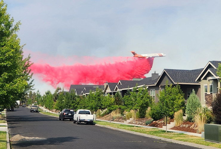
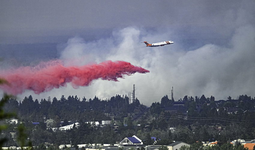
“The fire is showing a rapid rate of spread, with spotting ahead,” fire officials said in their X/Twitter feed around 4 p.m. Friday. “Multiple aircraft have been ordered and air attack is currently on scene.”
Around 8 p.m., Central Oregon fire officials said in an X/Twitter update: "Due to the hard work of all the cooperating agencies, ground and air resources have stopped the forward progression on Mile Marker 132 fire. The 20-acre fire started just east of Hwy 97, north of Cooley Rd & south of Beechcraft Ln. All aircraft released by 7:20 pm and now mopping up."
Friday's fire started not far from where the Juniper Ridge Fire nearly four years ago in mid-August 2020 burned nearly 40 acres, also prompting evacuations on Bend's north end. That fire was traced to the hot engine exhaust of a motor home in contact with grass and brush. No cause has been released on the new blaze as the investigation begins.
The Deschutes County Sheriff's Office issued first a Level 1 BE SET around 3:30 p.m., then a Level 3 GO NOW evacuation alert around 4 p.m. for the area east of Highway 97 and north of Cooley Road. Around 4:45 p.m., the alert was dropped to Level 2 BE SET for the area form Cooley Road to Wagontire Way and north of there remained at Level 3.
The evacuation levels had some adjustments at midday Saturday, as one area beside the highway north of Bend dropped from Level 3 to Level 2 BE SET. Then, on Sunday, the area of homes was dropped from Level 2 to Level 1 BE READY
Here's that report from Garibay:
UPDATE August 4, 2024 - 11 AM
After consultation with fire managers, the Deschutes County Sheriff's Office and Bend Police Department have adjusted evacuation levels around the Mile Marker 132 Fire. Current evacuations levels are as follows:
Level 3 Go Now: Juniper Ridge areas east of the Burlington Northern Santa Fe Railroad tracks, north of the city limits to the COID power generation facility.
Level 2 Be Set: None
Level 1 Be Ready: The east side of Hwy. 97 from the city limits north to Beechcraft Ln (private drive) and west of the Burlington Northern Santa Fe Railroad tracks. Residential north of Cooley Rd. between NE 18th St and Hwy 97NE 18th, Talus Place, and residents along the west side of Deschutes Market Rd.
Current evacuation maps can be found at www.deschutes.org/emergency
A temporary evacuation point and Red Cross shelter was set up Friday evening at Mountain View High School. But before 9 p.m. came word from DCSO that it "has been closed due to lack of need. If shelter needs arise related to evacuations for the Mile Marker 132 Fire, contact 1-800-REDCROSS."
You can check the latest Deschutes Alert notifications at https://member.everbridge.net/892807736723736/notif and the latest evacuation map at https://experience.arcgis.com/experience/6f8868c4477e462b8a653a89260268fc
While firefighters from numerous agencies and air support tackled the fast-moving flames, police went door to door in several mobile home parks and affected neighborhoods including homes off Hunters Circle, advising people to leave, and most of those who did encountered backed-up traffic due to knocked-out traffic signals.
This fire broke out amid temperatures at or above 100 degrees and a red flag warning of critical fire weather after over 100 fires burned over 1.2 million acres across Oregon over the past month.
Pacific Power initially reported 14,000 customers lost power due to damage to a line, but that was down to about 3,700 shortly after 5 p.m. and about 1,500 two hours later. Repairs were completed and the last power was resorted around 11 p.m. Check the latest outage map here.
One lane of Highway 97 was blocked the first couple of hours of the firefight but later reopened amid reports around 5:30 p.m. of good progress on stopping the blaze by ground crews and air tankers.


