C.O. wildfire updates: Green Ridge evacuation level reduced
But new 'red flag warning' brings threat of more thunderstorms
BEND, Ore. (KTVZ) -- A weekend of more favorable weather conditions made for good progress on several lightning-sparked Central Oregon wildfires, but a new red flag warning was issued Monday for a threat of more thunderstorms over the next couple of days.
The National Weather Service issued a red flag warning for thunderstorms, from noon Monday to 11 p.m. Tuesday.
A joint news release was issued Monday morning by the Deschutes and Jefferson County sheriff's offices:
The Level 2 (Get Set) Evacuation notices for residences north of Indian Ford between Green Ridge Rd (FS 11) and Fly Lake Rd (USFS 2050/2055) have been reduced to Level 1 (Be Ready) Pre-Evacuation Notice.
A Level 1 (Be Ready) Pre-Evacuation notice is issued for the following areas:
- Residences along Indian Ford Road from Hwy 20 to Stevens Canyon Road
- Residences east of Fly Lake Rd (FS 2055) to Stevens Canyon Rd (including all residences along Stevens Canyon Rd)
- Private residences and campgrounds west of USFS 14 within the Metolius Basin in the Camp Sherman area.
- Residences in Jefferson County north of the Deschutes County line, west of Whychus Creek and the Deschutes River north to Lake Billy Chinook. This includes areas commonly referred to as Geneva, Grandview, Three Rivers, Air Park Estates, Perry South and Monty Campgrounds.
Level 1: Means “BE READY“ for potential evacuation. Residents should be aware of the danger that exists in their area, monitor emergency services websites and local media outlets for information. This is the time for preparation and precautionary movements of persons with special needs, mobile property and (under certain circumstances) pets and livestock. If conditions worsen, emergency services personnel may contact you via an emergency notification system.
Please avoid these evacuation areas and abide by any area closures issued by the Deschutes National Forest.
Follow the Deschutes County Sheriff’s Office on Twitter and Facebook for up to date information.
Current maps including evacuation areas can be found at:
For fire information,, you can visit the Central Oregon Fire Information site at: www.centraloregonfire.org
Another virtual public meeting to update the Green Ridge Fire status is set for 6 p.m. Monday on the fire's Facebook page.
Green Ridge Fire
August 24, 2020 AM Briefing
https://www.facebook.com/Green-Ridge-Fire-Oregon
Twitter: @CentralOrFire
Green Ridge Fire Information: (541) 604 8461; staffed 8:00 a.m. to 9:00 p.m. daily
Web: https://inciweb.nwcg.gov/incident/7012/ email: greenridgefire2020@gmail.com
| Size as of IR flight: | 4,402 |
| Containment: | 2 % |
| Start Date/Time: | August 16, 2020 5:05 p.m. |
| Location: | Camp Sherman, OR |
| Cause: | Lightning |
| Personnel: | 509 |
| Assigned Resources: Hand Crews: Engines: Dozers: Water Tenders: Other Heavy Equipment: | 19 15 4 8 6 |
| Assigned Aircraft: Structure Task Forces: | 7 0 |
| Injuries: | 0 |
| Structures Threatened: | 108 |
| Structures Damaged: | 0 |
| Structures Destroyed: | 0 |
| Evacuations: | Level 1 issued for areas on east and west sides of fire; Level 2 reduced to Level 1. |
| For the most current evacuation information, contact the Incident Management Team Information Section (541) 604 8461 staffed 8:00 a.m. to 9:00 p.m. daily |
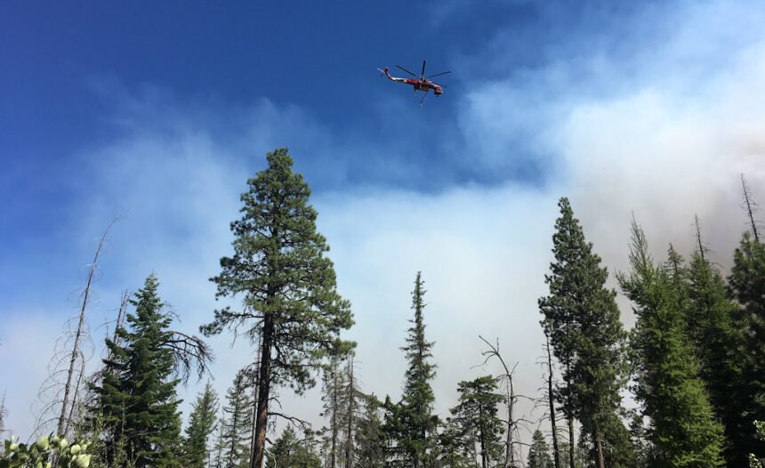
Camp Sherman, Ore. - Firefighters continue to make progress establishing and holding containment lines on the Green Ridge Fire, in spite of being challenged by repeated spot fires. The Prineville and Wolf Creek Interagency Hotshot crews successfully completed burnout operations on the western side of Green Ridge, bringing the edge of the fire down to more defensible, flat ground. Additional hand crews, engines and heavy equipment arrived yesterday to begin the process of mopping up, improving containment lines and patrolling for additional spot fires.
The Oregon Department of Forestry, Incident Management Team 3, will livestream a virtual public meeting tonight at 6 p.m. PST. The team will provide an overview of the current situation including updates on the fire’s condition, predicted weather and fire behavior, and operations strategies for the next several days. To participate, viewers do not need a Facebook account to view the meeting. The live stream will appear at the top of the Green Ridge Fire Facebook page a few minutes before 6:00 p.m. To join the meeting, please go to Facebook: https://www.facebook.com/greenridgefire2020
The Level 2 Evacuation notices for residences north of Indian Ford between Green Ridge Rd (FS 11) and Fly Lake Rd (USFS 2050/2055) have been reduced to Level 1 Pre-Evacuation Notice. A Level 1 (Be Ready) Pre-Evacuation notice is now in place for the following:
- Residences along Indian Ford Road from Hwy 20 to Stevens Canyon Road
- Residences east of Fly Lake Rd (FS 2055) to Stevens Canyon Rd (including all residences along Stevens Canyon Rd)
- Private residences and campgrounds west of USFS 14 within the Metolius Basin in the Camp Sherman area.
- Residences in Jefferson County north of the Deschutes County line, west of Whychus Creek and the Deschutes River north to Lake Billy Chinook. This includes areas commonly referred to as Geneva, Grandview, Three Rivers, Air Park Estates, Perry South and Monty Campgrounds.
For information about evacuation notices and Forest Area Closures go to: https://inciweb.nwcg.gov/incident/7012/
Weather will continue to challenge fire suppression on this fire and on fires throughout Central Oregon. The National Weather Service has issued a Red Flag Warning for Monday and Tuesday for thunderstorms, dry lightning and gusty winds. Although the Sisters Ranger District is excluded from the warning, storms passing nearby could still affect fire behavior with winds in excess of 20 mph.
ODF Team 3 remains committed to the safety of the public and wildland fire personnel. All fire personnel are expected to follow recommendations from the Centers for Disease Control for preventing the spread of COVID-19.
Frog Fire Update
Northwest Incident Management Team 8, Incident Commander, Doug Johnson
August 24, 2020 - 9:00 AM
The safety of the public and all wildland fire responders is always the number one priority for all wildland fire agencies. To keep firefighters and communities healthy and safe, all firefighters are asked to follow recommendations from the Centers for Disease Control and Prevention to reduce the spread of illness. This also includes limited entry into the incident command post and spike camp. Please see the websites below or contact the Frog Fire information center at 541-670-0812 for further fire information.
General Updates: The fire remained within its current footprint overnight with minimal fire behavior, including in the areas that saw interior torching yesterday. Today firefighters will reinforce control lines around the perimeter of the fire and engage in mop-up operations.
On the southern and eastern portions of the fire, crews will increase the depth of area cooled along the current perimeter to strengthen containment lines. On the northwestern flank of the fire, resources plan to focus their mop-up efforts on concentrated sources of heat near the existing fireline.
A red flag warning for thunderstorms and gusty winds has been issued beginning at 12:00 p.m today through 11:00 p.m. tomorrow. Overnight temperatures and good relative humidity recoveries along with increased cloud cover will moderate fire activity this morning providing advantageous conditions to secure lines and hot spots ahead of the afternoon’s potential weather event.
Northwest Incident Management Team 8 would like to thank the Brothers-Hampton and Post-Paulina Rangeland Fire Protection Association (RFPA) for their contributions to the suppression efforts of the Frog Fire. Cooperators and partners such as the RFPA resources have been released to be available to respond to any new starts.
Acreage: 3,997
Containment: 35%
Fire Information: 541-670-0812 (8:00 am to 9:00 PM)
E-mail: FrogWildFire2020@gmail.com
Information Websites:
Twitter: @CentralORFire
Blog Site: http://www.centraloregonfire.org
Inciweb: http://inciweb.nwcg.gov/incident/7036/
Smoke: oregonsmoke.blogspot.com
Weather: Partly cloudy with a slight chance of showers or thunderstorms this afternoon. Temperatures will range from 80-84 degrees with a relative humidity of 24-28%. Winds will be south 2-5 mph in the morning transitioning to west to northwest 6-10 mph this afternoon with gusts up to 16 mph.
Air Quality: The air quality rating is moderate in Prineville, Redmond and Bend. Moderate air quality is acceptable; however, people who are unusually sensitive could experience respiratory symptoms and may need to take precautionary measures. Smoke sensitive individuals are advised to stay inside whenever possible. A detailed smoke forecast for Oregon is available at oregonsmoke.blogspot.com.
Resources-482: 1-type 1 hand crew,3-type 2 initial attack crews, 10-type 2 crews, 1-light helicopter, 1-medium helicopter, 1-heavy helicopter, 19-engines, 3-skidgines, 6-dozers, 9-water tenders, 1 masticator and overhead
Evacuations: None
Closures: Several road closures and an area closure have been implemented near the Frog Fire.
The Crook County Sheriff’s Office has closed the following roads:
On the south end:
· Roberts Road at Bear Creek
· Klootchman Creek Road at Bear Creek
· Salt Creek at Roberts Road
On the north end:
· Forest Service Road 16 at the junction of Forest Service Road 1610
A temporary area closure also has been implemented by the Ochoco National Forest. For a full description and map of the area closure, please see the above Inciweb link.
Temporary Flight Restrictions: For the safety of firefighters and aircraft fighting the Frog Fire, a temporary flight restriction has been placed over the fire area. Please consult the Notice to Airmen for specifics.
Warm Springs fires update:
Update-August 24, 2020
For Immediate Release
Incident Commander: Eric Knerr, Northwest Team 7
Quick Facts
Incident Summaries
P-515 / Lionshead
Approximate
Size in Acres: 4,517 ac./2,372
ac.
Fire
Containment: 30% / 5%
Incident
Commander Eric Knerr
Resources
on the fire:
Crews: 16
Helicopters: 8
Engines: 16
Water Tenders: 4
Dozers: 7
Masticator: 3
Total
Personnel: 565
Jurisdiction: Confederated Tribes
of Warm Springs
Oregon Smoke Blog
http://oregonsmoke.blogspot.com/
Inciweb
https://inciweb.nwcg.gov/incident/7050/
https://inciweb.nwcg.gov/incident/7049/
Warm Springs, Oregon: This update is for the P-515 Fire and Lionshead Fire burning on the Warm Springs Reservation. Both fires are being managed for full suppression.
Current Situation: Yesterday’s inversion allowed firefighters to better secure fire lines around the P-515 Fire. Crews conducted burning operations in the northeastern flank to clean unburned pockets of fuel. The swing shift continued burning operations into the night on the western perimeter of the fire.
Yesterday, crews on the Lionshead Fire prepped roads east of the fire along the J-100 and J-200 roads. Direct line was also prepped on the P-440 road. The spot fire south of the Whitewater River was actively suppressed using aerial resources.
P-515 Fire: Containment is now up to 30% on the P-515 Fire. Today, firefighters will strengthen and expand control lines on all flanks of the fire. If conditions allow, crews will burn out along the fire on the northern perimeter to help secure the line. Firefighters will continue to extinguish spot fires on the northeast of the fire.
Lionshead Fire: Firefighters will improve the J-200 and J-100 roads to hold the fire to the north and west of these roads. Burning operations will connect indirect line on the southeastern flank and northern perimeter of the fire. Fire managers’ objective is to keep the main fire north of the Whitewater River to protect to water quality and fish habitat.
Weather and Fire Behavior: Cloud cover and continued smoke are forecast for today which will prevent full potential for fire behavior. Cooler temperatures and higher relative humidity are expected. Today’s inversion will last into the afternoon. Both fires may see rain showers later tonight. Firefighters may see occasional torching of trees and spotting of fires up to a quarter mile.
Closures: Trout Lake Road at pavement end; Road B140 at Potter’s Pond; Road B210 and Road P-500.
All trails south of Trout Lake, west of M-120 Metolious Bench, east of Mt. Jefferson, and north of J-195 will be closed to the public. Also, Tenino Road (P-200) will be closed to the public, only fire personnel and residents are allowed on Tenino Road (P-200).
Evacuations: A Level 1 Evacuation (Get Ready) is in effect for residents on Trout Lake Road east of US-26.
COVID-19: Precautionary measures have been implemented to prevent the spread of COVID-19. These measures include daily temperature screenings, mandatory use of face coverings, social distancing, and implementing more virtual work. Public and firefighter safety are a top priority.
Prevention Message: Make your home wildfire safe – Increase your defensible space.
Steet Mountain Fire/Laurel Fire
August 24, 2020 9:30 am
Oregon Department of Forestry IMT 2
Chris Cline, Incident Commander
@ODF_COD
Email contact—SteetMtnComplex.LaurelFire@gmail.com
Public Information Line: (541) 604-8483
Steet Mountain Fire—https://inciweb.nwcg.gov/incident/7039/
Laurel Fire—https://inciweb.nwcg.gov/incident/7037/
Size:
Steet Mtn Fire
Laurel Fire
701 Acres
1,280 Acres
Containment:
Steet Mtn Fire
Laurel Fire
70% *combined
25%
Start Date: August 18th, 2020
10:00pm
Location:
Steet Mtn Fire
Laurel Fire
Near Monument
6 miles S of Spray
Cause: Lightning
Est. Cost: $1,231,000
Personnel: 353
Resources: 1 Camp Crew
10 Hand Crew
18 Engines
7 Dozers
5 Water Tenders
3 Skidders
Aircraft: 1 - Type 2 Helicopter
2 - Type 3 Helicopter
Evacuations: None
Structures
Threatened:
4—hunting cabins on
Laurel fire
Structures
Damaged: 0
Structures
Destroyed: 0
Closures: None
Fire Summary:
Fire crews will continue to strengthen control lines, extinguish hot
spots, and mop up. The Steet Mountain and Laurel Fires held at 701
acres and 1,280 acres, respectively. The Laurel Fire is burning on lands
managed by Prineville BLM, the Wheeler County Rangeland Fire Protection Association, and ODF protected private lands six miles south of
Spray in Wheeler County.
Narrow roads with dusty conditions continue to make access to water
difficult for firefighters on the ground. Air resources will provide support to ground crews with water drops.
A fire weather watch is in effect for Central and Northeast Oregon this
afternoon through Tuesday evening due to gusty winds and low humidity. Abundant lightning and gusty outflow winds could impact fire suppression efforts. These conditions will challenge fire crews as they
work to hold and strengthen fire lines.
Heavy regional smoke from California will remain in the area. People
who are sensitive and may experience respiratory symptoms may need
to take precautionary measures. Smoke-sensitive individuals are advised to stay inside whenever possible. For updated smoke information
go to: oregonsmoke.blogspot.com
Continued support provided by the local communities has helped our
suppression efforts. Firefighter and public safety are our highest priority during this incident, including COVID mitigation. The incident command post and fire camp are closed to the public to ensure safety of
the public and the Firefighters
